Item Description
Original Item: Only One Available. British made topographical silk escape map of Western Europe typically carried by member of Parachute Infantry Regiments of both the 82nd Airborne and 101st Division.
A nearly identical map was carried by First Lieutenant Leonard Greenblatt during his service as a US soldier in Germany in May 1945. Leonard, age 23, enlisted in November 1941. He deployed with his unit, the 504th Parachute Infantry Regiment, 82nd Airborne Division, in April 1943 to French Morocco. Leonard was a platoon leader and participated in eight campaigns as the 504th advanced into Germany. On April 6, 1945, the unit crossed the Rhine near Hitsdorf, Germany, as a diversionary tactic to mislead the Germans for which it was awarded a Presidential citation. Leonard also was awarded a Bronze Star for his actions at Anzio. On May 2, the 82nd Airborne liberated Wobbelin prison camp. Leonard visited Wobbelin, took photographs, and wrote a letter home about the atrocities he witnessed. On May 7, 1945, Germany surrendered. The 82nd Airborne was placed on occupation duty in Berlin. Leonard returned to the US in September and was discharged in November. That map was later donated to the United States Shoah Memorial Museum in 2013 by Marilyn D. Greenblatt, the daughter of Leonard Greenblatt.
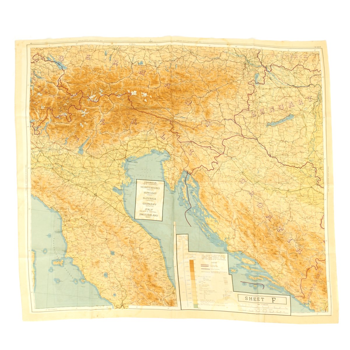
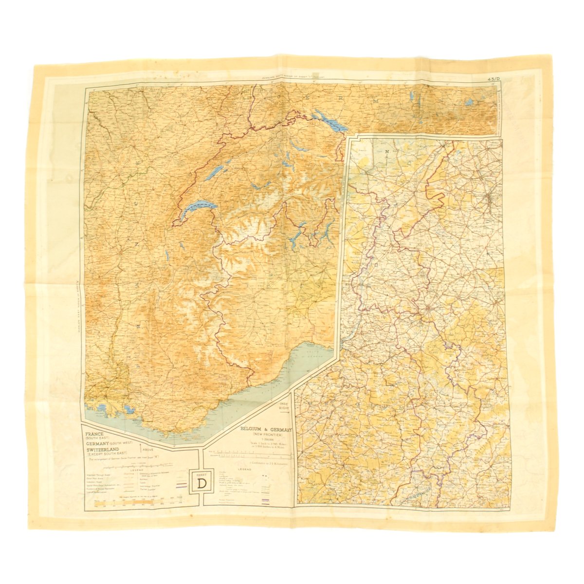
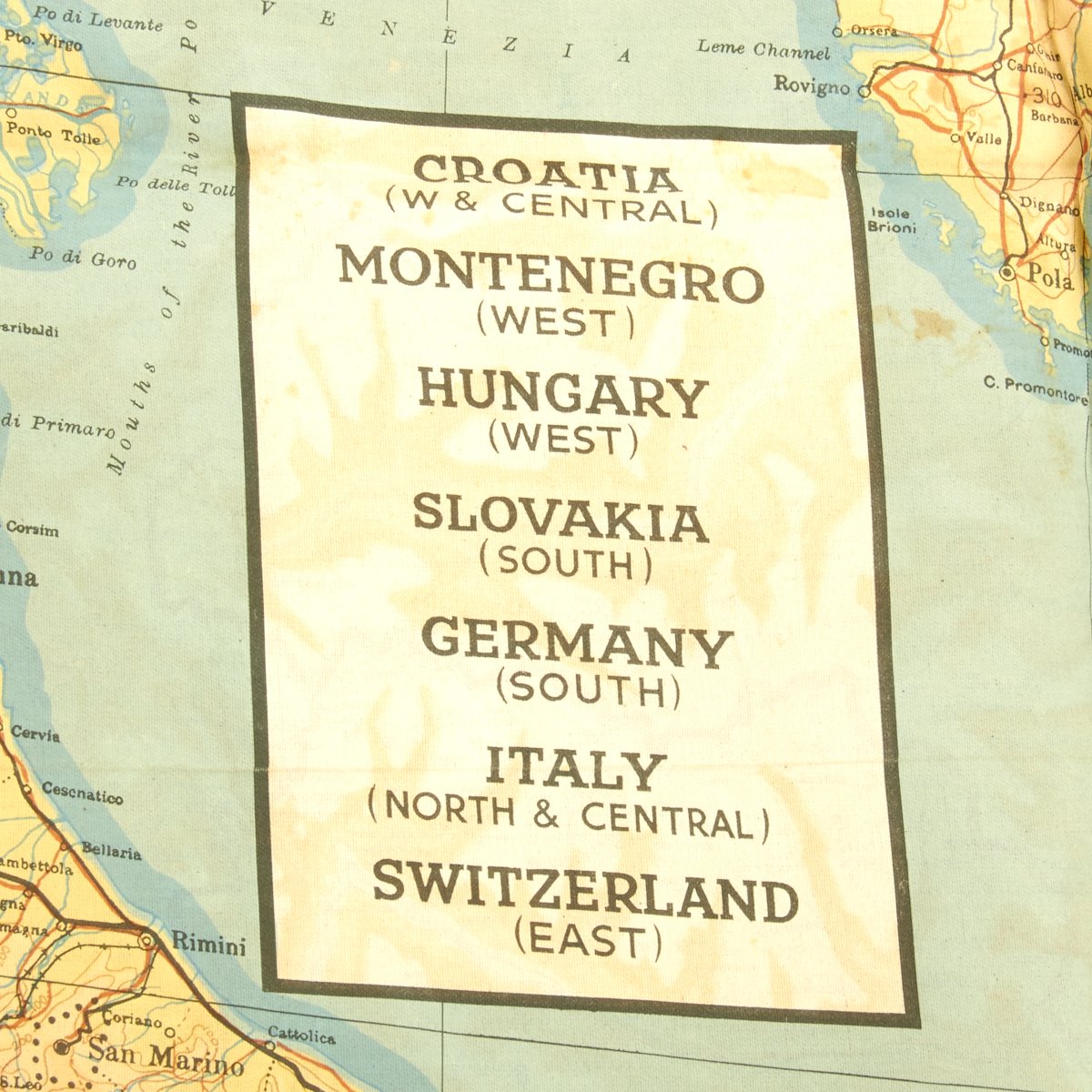
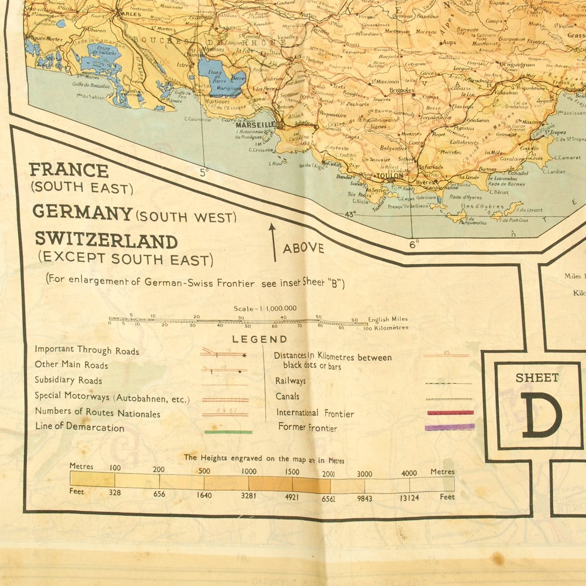
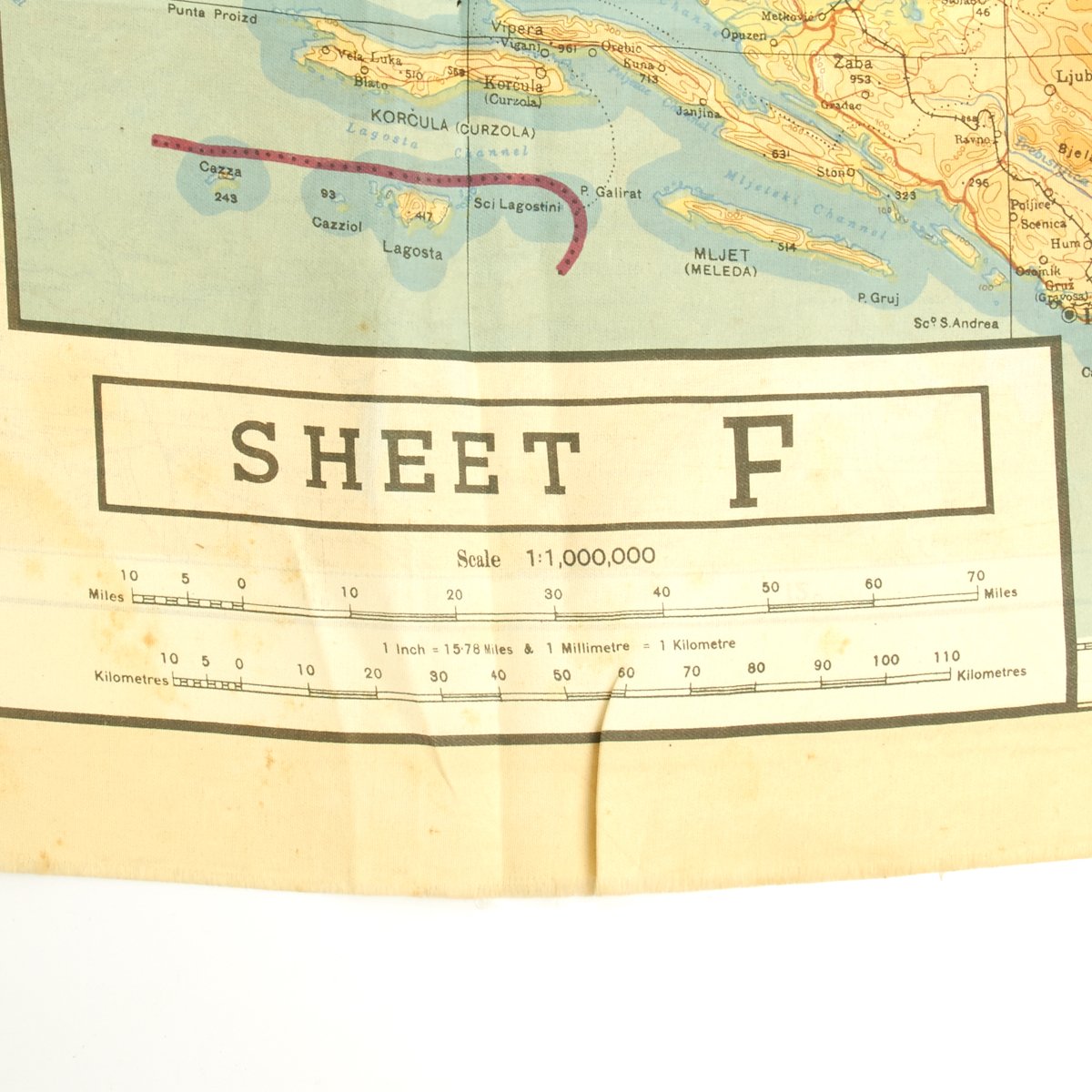
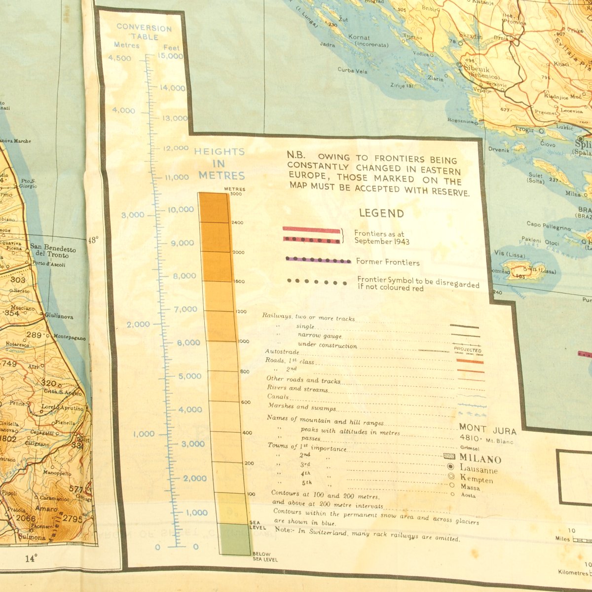
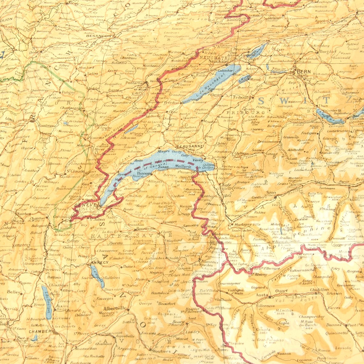
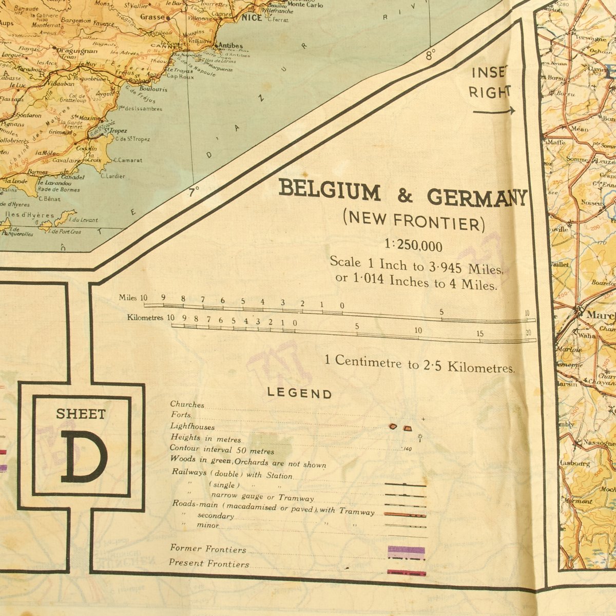
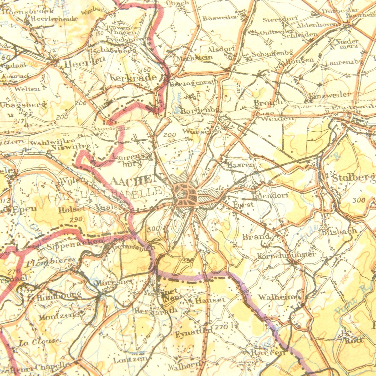
Double sided, square, off-white silk topographical map of Germany and bordering Western European nations and an inset of the new frontier between Germany and Belgium. Country names are printed in uppercase blue letters and cities and towns in black; the background is off-white with water in blue and mountains and elevated areas in shades of yellow and orange. The scale is 1: 1,000,000. The inset map is 1: 250,000, both with a kilometer and a mile scale. Longitude and latitude are numbered in a border around the map. On the main map, the front is labeled Sheet C, 43/C and depicts Holland, Belgium (Except West Coast), France (North East), and Germany (West & Central). The back is labeled Sheet F, 43/F and depicts Croatia (W & Central), Montenegro (West), and Hungary (West), Slovakia (south), Germany (south), Italy (North & Central). There are legends for the main and inset maps with an elevation scale in meters and feet, important roadway features, and former and present frontiers. The front has a legend in the top left corner and the back main and inset legends are along the bottom.
- This product is available for international shipping.
- Eligible for all payments - Visa, Mastercard, Discover, AMEX, Paypal & Sezzle
YOU MAY ALSO LIKE